I am working in an MNC in London, United Kingdom for 5 years. Now my company wants to expand its business in London. So in order to do so, it has to open a lot of new shops particulary in East Central, London.
So me being the country head of United Kingdom, the company wants me to move to the East Central London in order to look after the new shops in a more better way and also I can address any problem happening there in the new shops.
Now the problem is that I am current living in West London with my family and in order to move to East Central London . I need to shift my family too and in order to get reimbursement from my company I need to show them a perfect location in the East Central London for my living.
So that I can get a place which is near from every good and exotic locations of our stores in East Central London and can have my family there and also look upto these stores whenever needed.
I am required to present a report in order to give a best location for purchasing a house in the area of East Central London.
Since London is a very big city and according my budget the only locality I will be able to purchase a house will be in East Central. So I wanted a perfect location in that locality in which I can purchase my house and shift my family there,
London being such a big and world famous city, it is really hard to pick up a house to live that too in the East Central London as the place is a home for many foreigners.
IIn my analysis I found that living beside Bank of England or Cannon Street it will be the best place for me as they are close to the locations where I need to work ok and look after my I my stores and also so I will be able to get remuneration for my home in those districts.n order to find out the best location in East Central London. I, first, decided to get the data of postal codes of districts of East Central London. I got that easily form wikipedia. In order to make the data compatible for analysis. I first have to find the correct table in order to make it compatible for analysis as there were two or more tables in the website. Initially it was difficult for me to find out the correct table but I used pandas data frame tools to find out the correct table and import it in my code.
After that I needed to find the latitudes and longitudes of the concerned districts. But what I had was of overall London. So I needed to refine the data in order to use it. I first dropped the unnecessary columns then I sorted the duplicates present in the code and then I merged the data with my required dataframe.
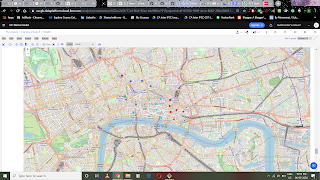
Then I imported the concerned libraries which will I need for my plotting and for my analysis. Use geo locater and folium maps, in order to find the coordinates of London or you can say East Central London then I used those coordinates and plotted the map of London along with the district data which I have. When I use my forsquare id and password to get the nearby locations of different district in East Central London.
It was important for me too find the best places according to the closeness from their main city so so I used FourSquare accordingly. Then I created a data frame for my when use according to their district location but it was difficult for me to identify the best district in the locality.
I find the top 10 places according to their distance from the the main city and showed them according to their postal districts.
Then I perform the cluster analysis of ten clusters according to my data.
I will have to show the company a detailed report of my surroundings and for that I will perform some analysis over the area of the East Central London.


